September road trip

September road trip
September road trip

Wednesday, April 30, 2014

Leaving New Mexico

Sunday was our last day in Los Alamos. Millie and her daughter went to the store in the morning, we mostly just hung out as we don't need much preparation to leave in the morning. We had birthday cake for me in the afternoon.


Monday we drove about 75 miles north to Taos New Mexico. and stayed at a nice campground right in town. (Taos Valley RV Park and Campground) We stayed in Taos two nights, went to Rio Grande Gorge which is 700 feet deep, the downtown plaza in Taos, kind of like the Santee Fe plaza but smaller. Like Santee Fe you can buy authentic Indian made jewelry and tourist souvenirs. Taos also has many art gallery's. Besides being a ski resort, Taos is also noted for being an artist colony.


We drove thru a mountain pass to Angel fire to visit the Vietnam Veterans memorial. Originally built by the parents of a young Marine lieutenant who along with sixteen of his men where killed in an ambush in Vietnam. It is now a New Mexico state park and a memorial to all who served in Vietnam.


Wednesday we departed Taos and took the motorhome through the mountain pass to Angel fire and followed the route of the pioneer days Santee Fe trail north to Raton and continued following it east toward Oklahoma. Our destination for the day was Guymon Oklahoma a journey of a little less than 300 miles.


 Without a doubt the most interesting aspect of Wednesdays drive is the landscape of Northeastern New Mexico. I am not capable of writing the words that would vividly describe this amazing landscape. Our journey started as a meandering two lane road through a mountain pass. Other than the asphalt roadway I'm sure it looked the same many years ago when wagon trains of pioneers gazed up at the towering snow capped mountains, some as high as 13000 feet. On the other side of the pass a wide valley stretches between mountain ranges. Covered in natural prairie grass it goes on for miles with no sign of human habitation. I stopped several times right in the middle of the road for several minutes at a time and no cars could be seen coming from either horizon. Mule deer graze on the shoulders, prairie dogs play in the road, why, I don't know. The town of Raton is like an oasis, our road (rt 64) and I-25 cross here and the small town has all the expected amenities modern travelers would want.


After lunch and refueling we traveled east leaving the little metropolis and once again entering a desolate landscape. slowly the land became grass covered rolling hills then flattened into irrigated farmland as we neared the Oklahoma border.


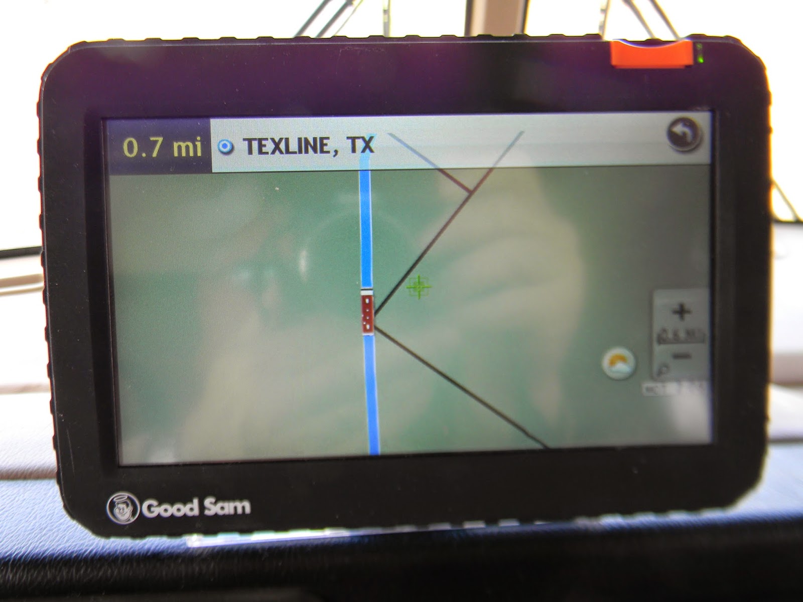
There is an interesting spot along rt 64 just a few miles shy of the Oklahoma border. There is a dirt road that angles up to meet rt 64. This intersection is the northwest border of the state of Texas. There is no marker, no souvenir shops, just an old livestock pen, but from here to the South Padre Island the extreme southern most point in Texas is 900 miles.


Soon after we entered Oklahoma the winds started picking up, coming from the north they were hitting us broadside before circling down and around to create the Santa Anna winds for California.  Although it didn't seem that strong while driving a strong gust popped the fiberglass roof out of its aluminum channel for the entire length of the motorhome on the drivers side.


I stopped at Boise City and bought two rolls of duck tape at the John Deere tractor dealership. I parked the motorhome on a lot where an old building had been torn down and made a temporary repair. While I was on the roof putting the fiberglass roof sheeting back in the channel and securing it with duct tape, Millie found a 1900 quarter on the ground, that was pretty cool.

After the repair we drove another 45 miles to our overnight destination in Guymon Oklahoma. We are staying at a drive-in movie theater that has a section of the parking area converted into RV spaces. unfortunately for us they're not showing a movie until Friday.

Saturday, April 26, 2014

Los Alamos- week 2


It’s Saturday April 26th and we’ve been in Los Alamos almost two weeks. Once again we have had a relaxing week. I did a few projects on the motorhome and Millie did some sewing, using Ray Anne’s large dining room table as a sewing table. Millie is very talented; she made a dress on Rae Anne’s machine in the time it took me to troubleshoot the bobbin winder on her motorhome sewing machine.

I installed a receptacle in the living area behind the driver’s seat. I had to do the same thing with the old motorhome; I don’t know why the manufacturers neglect to serve this area with power. In the process of doing the receptacle I inventoried all the receptacles in the coach. I discovered that the three receptacle circuits are not balanced very well. Two circuits on the passenger side are lightly loaded and the third circuit is the one we use the most. I have studied the area within which I can route wires and plan on separating the driver’s side into three separate circuits the next time we stop in one location for a few days.


Everyday I take the girls walking on the National Forest trails that pass close by our parking spot. Maggie and Dixie don’t talk much so it gives me lots of time to contemplate the great mystery of how this rugged but beautiful landscape was created. New Mexico has some of the most fascinating landscape that we’ve seen anywhere, most of it is uninhabited and just the same as it’s been for millions of years.


As you know there are two predominate theories as to how the earth and the universe where created, both equally farfetched to my simple way of reasoning. The religious simply state; God did it. The scientist’s say 13.82 billion years ago the whole universe was densely packed into a pinpoint and it exploded. 


I’m not going into the faith based explanation, the rugged mountains have me in a pragmatic state of mind and New Mexico sure looks to me like it was created in a cataclysmic event. The physical evidence all around me makes the explosive theory sound logical and many learned people have studied it and provide a chain of evidence to support the theory. My ponderance is this; before the Big Bang when all the matter of the universe was packed into one point, where did the point come from? 


While you’re mulling that over, let me finish by blaming my mental wandering on this land of enchantment, the western mountains made John Denver a folk singer and me a philosopher. It is an intriguing place and I like exploring here more each time we visit, but I’m not planning on leaving the beach anytime soon, there’s still snow in the mountains here! 


This morning the whole family got up early and participated in a 2 mile dog trot to raise funds for the local animal shelter. Evan and Marcus went the easy way, riding in strollers pushed by their parents.  Dixie who has never fully recovered from being hit by a truck started lagging after one mile and rode the rest of the way in one of the strollers. Maggie walked almost the whole way, I carried her for about one hundred yards at the halfway mark and she was ready to go again.
High winds are expected for the weekend here, but we hope to be able to leave on Monday. As nice as it is here, we can hear the open road calling and we just gotta go!


UPDATE: As I write this on Saturday evening the wind is blowing 30-40 mph and gusting to who knows how fast. But that’s all good; it’s blowing the snow that’s falling into the next county!

Monday, April 21, 2014

Los Alamos


We are now in Los Alamos, New Mexico having taken the short trip up from Albuquerque on Tuesday the 15th. We are once again camped in Rae Anne and Dave’s driveway on the edge of the Los Alamos National Forest. The boys, Evan and Marcus were thrilled to see their grandma again and we are enjoying them as well. They run to the motorhome everyday after school to sit in the driver’s seat and beep the horn. (I stuffed the horns with rags to muffle them)  
Marcus at Wecks Resturant


Other than the madcap couple hours between the boys arriving from school and them having to go in the house for dinner we’ve had a quiet week. I did a few minor repairs to the motorhome and Millie and I washed it, but that’s all the work we’ve done.


On Thursday we went to a nearby part of Bandelier National Park. Tsankawi ruins (sank-ah-WEE) is the site of an old Indian village, it was built by Ancestral Pueblo Indians. Archeological evidence indicates that Tsankawi may have been constructed in the 1400s A.D. and occupied until the late 16th century.


The 1.5 mile trail through Tsankawi takes you along centuries-old paths to the top of the Mesa. There are also several ladders you must scale. In many areas, the trails have been worn into the rock 8 to 24 inches or more as the people traveled from the mesa tops to their farms in the canyons below. 


After the moderately strenuous trek up to the ruins and then back down, we were ready for lunch. We’re used to breathing fat sea level air and it’s a little thin here at 6500+/_ feet. On the way home we stopped for sandwiches and enjoyed a picnic lunch at Los Alamos’s downtown park.


Saturday the family went to a Mexican restaurant in Santee Fee. Wecks is a family friendly chain with restaurants in Albuquerque and Santee Fee. They only serve Breakfast and Lunch; by the time we drive down from Los Alamos we’re eating brunch but that’s ok it usually means a shorter wait for a table.
Evan at Wecks


Millie and I stayed in Santee Fee after brunch, browsing in the downtown historic district. I bought a couple shirts and Millie got a great deal on a weatherproof jacket.


Sunday the boys had an Easter egg hunt in the yard followed by a bunny cake that Millie made for them.

Note: I’m going to try to insert a link to Flickr with more pictures of the Tsankawi ruins.

Tsankawi ruins album on Flickr


Wednesday, April 16, 2014

Albuquerque, New Mexico


2014-04-13

Sunday the 13th we departed Alamogordo for a short trip up to Albuquerque. The 13th is also our first wedding anniversary and we feel it’s appropriate that we‘re traveling because we enjoy it so much. Our route took us through an interesting geographic formation. State road 380 passes through a 5000 year old lava flow called Valley of Fires.  It is four to six miles wide, 160 feet thick and covers 125 square miles. Our route also took us within twenty miles of the Trinity Site, where the world’s first nuclear explosion was detonated. it is closed to the public all but one day per year.

Valley of Fires

Our destination in Albuquerque is the Enchanted Trail RV Park. It sits on a short section of what was Route 66 and is now a local access road along I-40. The Adobe office building dates to the 40’s and was a trading post. In 1950 the property was converted into a campground. The neatest thing about the campground is their exhibit of restored antique travel trailers.
Enchanted Trails RV Park


A wind storm rose up out of the west and blew 25-30 mph hour winds with gusts to 55 mph for 18 hours so we didn’t do much here. The blowing dust blocked out the sky and made going outside an unpleasant experience. I did manage to get the dogs outside a couple times when the winds slowed a little.


Our 2nd day in town the storm over, we went on a shopping expedition. We had researched online for stores that carried some specific items we needed. We drove a large loop around the city picking up items like raw cashews, Eagle Pack Dog food, and natural ingredient mouth wash. Not changing a dogs diet is something I’m sure you all understand. The other strange items are my doing, but I’m a senior citizen, I’m allowed to have strange quirks.
No we didn't see this, The balloon fest is in October


Costs: Enchanted Trails Campground is affiliated with a discount program called Coast to Coast that we belong to so we paid $16. per night to stay here. Fuel in this part of the country is advertised at $3.30 to $3.50 but that a bit deceiving. The low advertised price is for 85 or 86 octane. The motorhome engine works to hard to use less than its recommended 87 octane. We’ve been paying $3.59 to $3.69 for 88-91 octane.

Sunday, April 13, 2014

Alamogordo, New Mexico


04/11/2014

Friday was our day to move on to Alamogordo, but we had to wait until after a phone conference with the Cane Patch Board of Directors. (The Cane Patch is our condominium in Myrtle Beach) We had the bus ready to go and departed as soon as we concluded our quarterly meeting. The route was only about 125 miles so it was an easy run. One hundred miles was due west and crossed a wide flat plain. As we drove across the vast expanse I sensed a slight uphill grade. 
Lincoln National Forest


We could see the mountain range from a long way off, but were still surprised when we reached it. The mountains were covered with evergreen trees and the valley of the mountain pass was lush with grass. This is definitely not the barren rock New Mexico we’re used to. As we got closer to the western side of the mountain range we started getting glimpses of the valley far below. We had gradually climbed to 8500 feet and would now descend to 4500 feet in 16 miles. 
Highway 82's rapid descent from the Sacramento mountains


We had 26,000 lbs going downhill but between the jeep and the motorhome we have 8 brake calipers and 10 tires gripping the road. We descended in 2nd gear and used intermittent braking to stay below 35 mph while enjoying the varied and beautiful countryside as the mountain pass cut thru Lincoln National Forest.
Mountain tunnel in Lincoln National Park


Once again we are guests of an Elks Lodge, this one in Alamogordo, New Mexico. We are enjoying a full hookup site plus Wi-Fi for a $15 a night donation. The lodge is in a nice neighborhood on the outskirts of town, a new housing development on one side and a golf course on the other.
Maggie rolling in the golf course grass


This afternoon after the last two golf duo’s played thru; I took the girls for a run on the edge of the course. Both dogs enjoyed running on the lush green grass but Maggie was in 7th heaven. She rolled and rolled in the grass, stopping to scratch her back and nuzzling her snout into the golf course turf. This is probably the first thick green grass she’s had to play in since Bayou Segnette Park near New Orleans. Dixie the little lady stretched her retractable leach to its limit to distance herself from her rambunctious sister.
Millie on top of a sand dune


We toured White Sands National Monument which is about 13 miles west of town. We did the driving tour, walked the boardwalk thru the dunes, and climbed to the top of a dune for pictures. Not to belittle the park, it is amazing to see all that powdered gypsum, but the thing that sticks in my mind is the big sign at the entrance. In two languages it said “Absolutely no alcohol allowed in the park between February 1 and May 31st.” What?  I just had to ask the toll attendant. She must get asked the question a lot because she answered right away “It’s because of Spring Break”. At first it seemed a little crazy but it makes sense, it’s a long way to the traditional spring break beaches and the only thing missing here is the water.
Sand dunes cover an eighteen by three mile area


Back in Alamogordo we did a driving tour of this home to 31,000. The most unusual thing we noticed is the whole town is low level, 95% of the buildings are less than 2 stories high. After a brief resupply stop at Wal-Mart we sat down to one of the best Mexican meals we’ve ever had. It was at a local restaurant called Margo’s and everything about the meal was just excellent. Dinner for 2 including tip and tax was $30. and we took home enough for another meal.


PS: White Sands was the third time this trip we’ve used our National Parks Senior Pass for no cost entry. The pass only costs $10 and is good for life, it’s a good deal

Saturday, April 12, 2014

Carlsbad Caverns and MTA Charlie

Sunset over Bradley Lake


Bradley Lake is at least the 3rd or 4th large reservoir we’ve seen this trip that has a very low water level, that’s getting kind of scary. The state park campground sits on a knoll overlooking the lake. The campground is very nice, the only negative is the burr’s growing everywhere; the dogs have to stay on the paved surfaces or the camp site.
On the road to Carlsbad Caverns


On Thursday we went to Carlsbad Caverns National Park to tour the big cave. We elected to walk down the natural entrance, a long decline of 800 feet spread over 1.5 miles. At the bottom we took the 1.5 mile self guided tour. 
This is the entrance if you choose to walk down the natural entrance


After about 3 hours underground I thought one of the large stalagmites looked familiar and for a minute I thought we had been here before and were going in circles. You really can’t do that because you follow a paved walkway with handrails on each side. Other than a short cut to the elevators about half way thru the walk you just follow the path to the end.
Stalactites and stalagmites in the big room


 I couldn’t help thinking of the old folk song about Charlie and the MTA. It was a protest song after the transit authority in Boston (circa 1949) raised the subway price by a nickel. Charlie gets on the subway but doesn’t have the extra nickel for the exit fare so cannot get off. The chorus went;

    Did he ever return?
    No he never returned
    And his fate is still unlearn'd
    He may ride forever
    'neath the streets of Boston
    He's the man who never returned.

So I’ve got this song replaying in my head as we round a dark bend in the path. Around the corner one of the wall fixtures cast a dim light on a small bench and there sat Charlie! The old man sat in silence with the forlorn look of someone in a hopeless situation, his long hair and beard completed my mental picture of Charlie still riding beneath the streets of Boston. “Did he ever return, no he never returned, and his fate is.........”
Hard to believe these huge stalagmites where formed by dripping water


We meandered along and completed the self guided tour in about 4 hours, then taking the elevator 800 feet to the surface. The huge cave is quite an experience and one we feel everyone should add to their bucket list.

Friday, April 11, 2014

Out of Texas


2014/04/08

Departed Uvalde Texas on Tuesday morning and drove west on highway 90. We passed through hill country, the terrain still a mix of mesquite and scrub brush until we passed Del Rio. As we entered the Big Bend region it became increasingly desert. We stayed on 90 until we reached Marathon, a small dusty town made memorable for the $3.77 we paid for 87 octane gasoline.
Highest we've paid for fuel, so far!


Turning south on SR 285 we headed to today’s destination, Big Bend National Park. As we entered the huge park the first noticeable change is the mountains rising on each side of the road that winds through the valley. I think young and healthy hikers would like the trails that lead off into the mountain passes and plateaus, the rest of us just drive through and enjoy the scenery.

The campground in the park with electric hook ups was full so we stayed in an RV Park just outside the west park entrance. ($29 for one night) Mileage driven today 320+/-.

2014/04/09

There are two parallel roads that go from Highway 90 to Big Bend, we went to the park on one (SR385) and returned north on SR 338. Millie and I both agreed 338 is the more scenic road, even nicer than the views in the park. The only determent is the fences, power poles, etc that line the public road while the park road has no modern utilities along its road.
Big Bend Region of Texas


The beautiful mountains continued all the way to the New Mexico border. A lot of Texas we’ve seen both on this trip and previous visits looks the same, all are varying degrees of dry arid landscape. The big Bend region is also dry, but the low lands are covered with prairie grass rather than desert scrub and the mountains are rugged.

In the upper part of the Texas Big Bend region and continuing over the border into New Mexico the oil drilling and oil wells were evident again. The same operations as we had seen in the south so I’ll assume they are also Fracking for oil here too.

We drove about 30 miles into New Mexico and are camped at Brantley Lake State Park. ($18 a night) Next attraction is Carlsbad Caverns, details in next entry. 
The zig-zag route thru Texas

Monday, April 7, 2014

Rio Grande Valley to the Badlands


04-06=2014

As planned we went across the border on Friday to Mexico. Neuvo Progreso is a small border town that caters to American and Canadian visitors. The easiest way to go is to park on the American side ($2.00 all day) and walk across the bridge. It costs a toll of 35 cents to walk across. Mexican Customs doesn’t pay any attention to pedestrians. On your return you walk across the other side of the bridge, again paying a 35 cent toll. American Customs checks your credentials and asks if you have anything to declare.
Millie at the Tex/Mex border


You start to get an idea of what Progreso is going to be like as you walk the bridge. When you get to the Mexican side beggars call from the river bank below asking for thrown coins. They are also on the streets of the town but not to many, they must control them somehow. The town itself has a third world feel, it definitely makes you appreciate the good old USA.
Neuvo Progreso


The Mexican people of Progreso are not threatening but they are constantly trying to sell you something. As you walk the tourist area you will be offered all manner of goods and services. Fortunately a polite “no thank you” is all that is needed for them to stop, they’re not at all aggressive. Dentistry, optical, and pharmacies are everywhere, followed by pedicures, barber shops, shoe shine stands and of course souvenir stores. I had nothing to declare at the border, Millie purchased a small leather bag.

The Elks lodge had a dance on Friday evening with a country band called “Dixon”. They played good traditional country music and the audience, dressed in western wear was dancing to every number. We got to practice our waltz as they seemed to mostly alternate between waltz’s and Texas two steps.

Saturday morning we took the girls to Petsmart for a day at the spa. They both got shampoo’s, haircuts, the whole spa package. They’re both pretty and they know it!

The drive to South Padre Island from Harlingen starts out as suburban housing and shopping and then changes to vast expanses of the agriculture the Rio Grande Valley is noted for. On Saturday afternoon we visited the resort oasis and even though it is small it seems to have all the expected activities of a beach town. It has a harbor which offers fishing trips, scuba diving, Jet Ski rentals, etc. There are many condo’s, restaurants, beach souvenir shops and of course the beach.


04/06/2014 Sunday:

After thoroughly enjoying our 3 day stay at the Elks lodge we departed the Rio Grande Valley. You don’t have to venture far down the highway and you can see a back to nature progression. As soon as mans cultivation and irrigation stops, the land reverts to mesquite dominated desert vegetation. As you drive west you pass through mile after mile of nothing but mesquite and cactus. The long stretches between towns seem desolate but there is a lot of activity in this scrub wasteland. Shale oil wells are being drilled all over out here. Hastily built trailer parks are everywhere as housing for the oil field workers. There are a lot of 35 foot FEMA trailers being used as housing along with fifth wheel campers and some motorhomes. These are the same RV’s that some of the New Orleans evacuee’s complained about, resulting in FEMA’s selling all the trailers. Interesting, Orlinians thought they were too good for a “free” temporary home and these hard working folks out here are paying around $300 a month to rent them.
Our route from the Rio Grande Valley to the badlands.
  

We passed thru Lerado only stopping briefly for fuel. I-35 starts downtown and goes north bisecting San Antonio, Austin and Dallas on its way to Oklahoma. Our road, SR 83 shares concrete with I-35 for about 15 miles before 83 goes off to the west again. Almost as soon as we left the interstate we were in desolate hard scrabble territory. The land is inhospitable; the few villages look tired and poor. The few RV parks we saw are all full of oil field workers. I had a tentative destination in mind but no reservations so we were winging it today.

The office at Quail Springs RV Resort was closed when we got there but they have self check in policy so we made ourselves at home. ($26 a night) It’s a wonderful little campground nettled under a canopy of live Oaks in the town of Uvalde. The town is the first nice place we’ve seen in a while, home to 15 thousand it is large enough to have all the amenities, out here it is truly an Oasis.
"The bus" at Quail Springs Rv Park


We are staying two nights, we spent the day doing necessary chores, resting and getting ready for the next adventure.

The one negative is, we have no Verizon broadband service here; our phones work for voice but must be roaming on another phone tower. This is the first time since using our phones as broadband hotspots that we have not had any service. We have connected to the Campground Wi-Fi and it seems ok most of the time.

Tomorrow we head to the Big Bend National Park, it is along the Mexican border in a forgotten corner of Texas and I’m assuming we will be without internet access again, so it will be a few days before we post again.